
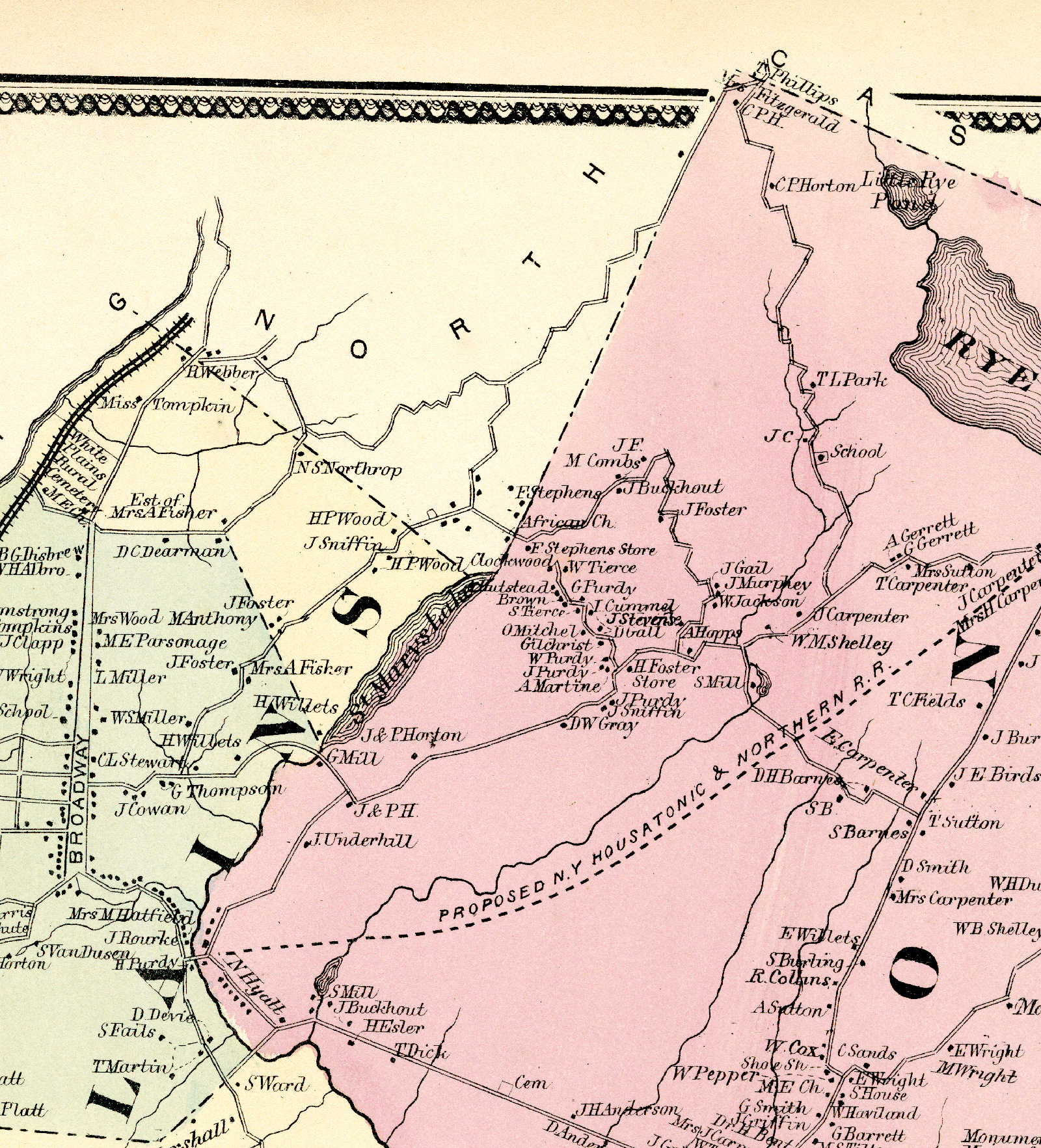
Closeup of The Hills Community as Shown in 1867 Beers Map.

Description
"Close-up showing Stony Hill Road, the principle area of settlement in the Harrison section of The Hills". The names of the property owners are shown on the map.
Creator
Beers, F.W.
Date
1867
Subject
The Hills Harrison New York
Publisher
Beers, F.W.
Ellis, A.D.
Soule, C.G.
Type
Image
Format
Linen Book 15" x 18"
Source
Quinn, Edythe Ann. Freedom Journey: Black Civil War Soldiers and The Hills Community, Westchester County, New York, Albany: State University of New York Press, c2015, gallery 2.
The map is at the Westchester County Historical Society.
Language
en-US
Rights
This material may be protected by the U.S. Copyright Law (Title 17, U.S.C.). Fair use of this content is permitted as defined by copyright law. Responsibility for determining fair use lies with the user. The user is responsible for any claims that may arise.
Citation
Beers, F.W., “Closeup of The Hills Community as Shown in 1867 Beers Map.,” Harrison Remembers, accessed April 20, 2024, https://www.harrisonpl.org/harrison-remembers/items/show/88.